Severe weather becomes significantly more active across the eastern half of the country this week, with repeated storm opportunities developing across several heavily populated markets.
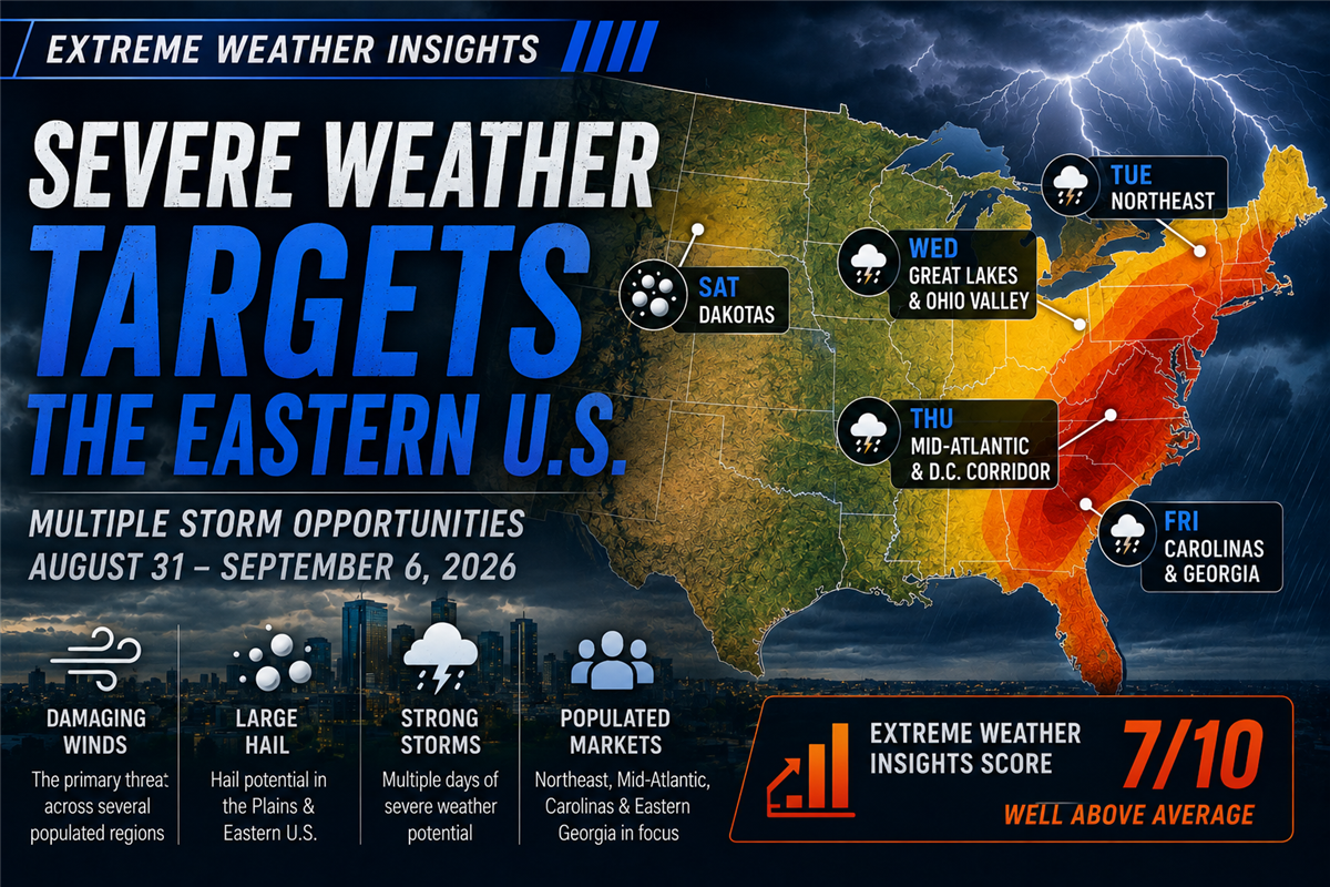
For August 31–September 6, 2026, Dr. Gensini gives this week an Extreme Weather Insights Score of 7/10 — well above average for this time of year. The primary focus shifts toward the Northeast, Mid-Atlantic and Southeast, with damaging winds, large hail and strong thunderstorms possible across multiple regions throughout the week.
Last Week: Great Plains Hail Leads the Severe Weather Activity
Last week's forecast focused heavily on the Central Great Plains, with additional opportunities across portions of the Midwest and eastern United States.
The resulting storm activity matched that pattern well, with the strongest concentration occurring across the Great Plains. Dr. Gensini noted 13 major hail reports, with nearly all of them occurring across that region.
The Midwest was comparatively quiet, while scattered severe weather developed farther east. Once again, however, damaging wind reports dominated the overall storm totals.
Hail Remains Below Average While Wind Stays Exceptionally Active
One of the defining severe-weather trends of 2026 remains the gap between hail and wind activity.
Hail continues to run approximately 500 reports below the 15-year average. Wind, meanwhile, is moving in the opposite direction.
Dr. Gensini estimates that damaging wind reports are currently roughly 5,000 reports above what would typically be expected at this point in the year.
That contrast has become one of the most notable features of this year's storm season: below-average hail activity paired with unusually high damaging-wind activity.
Monday: Mostly Quiet Severe Weather
The week begins relatively quietly from a severe-weather standpoint.
Showers and thunderstorms are moving through portions of the Great Lakes, including the Chicago area, while the Desert Southwest continues to experience monsoon-driven heavy rain and lightning.
Despite plenty of heat, humidity and thunderstorm fuel across the central United States, limited wind shear should prevent most storms from becoming organized enough to produce widespread damaging winds or large hail.
Tuesday: Severe Weather Reaches the Northeast
The severe-weather pattern begins to change Tuesday as stronger wind shear moves south from Canada.
The primary risk shifts into the Northeast, reaching close to the New York City metropolitan area and several other densely populated markets.
This marks the beginning of a multi-day stretch in which the eastern United States becomes the primary severe-weather focus.
Wednesday: Great Lakes, Ohio Valley and Mid-Atlantic
By Wednesday, the severe-weather corridor expands considerably.
The risk extends across much of the southern Great Lakes and Ohio Valley before reaching east toward Washington, D.C. and New York.
That puts a large number of heavily populated markets within the week's storm corridor and makes Wednesday one of the more important days for contractors operating across the eastern U.S.
Thursday: Threat Shifts Slightly South
Thursday brings a similar setup, but the primary severe-weather corridor shifts farther south.
The risk again includes Washington, D.C. and extends west toward areas near Indianapolis.
Repeated thunderstorm activity means many eastern markets could experience multiple opportunities for strong or severe storms as the week progresses.
Friday: Carolinas and Georgia Come Into Focus
By Friday, the severe-weather risk shifts farther into the Southeast and expands geographically.
Key areas include:
- Virginia
- North Carolina
- South Carolina
- The Piedmont region of Georgia
These markets represent some of the week's most important areas to monitor as the storm corridor continues moving south and east.
Saturday: Large Hail Returns to the Dakotas
Saturday brings two separate severe-weather areas.
Across the Dakotas, scattered thunderstorms could produce hail approaching golf-ball size.
At the same time, another severe-weather risk remains across portions of the Carolinas, where damaging winds, lightning and large hail will all be possible.
Sunday: Severe Weather Quietens Down
Sunday currently appears much quieter, with no significant severe-weather activity expected as the week comes to a close.
What Roofing Contractors Should Watch This Week
This week's weather story is less about one isolated outbreak and more about a multi-day severe-weather corridor moving through densely populated eastern markets.
- Monday: Generally quiet severe-weather conditions
- Tuesday: Northeast, including areas near New York City
- Wednesday: Southern Great Lakes, Ohio Valley, Washington, D.C. and New York
- Thursday: D.C. west toward areas near Indianapolis
- Friday: Virginia, North Carolina, South Carolina and eastern Georgia
- Saturday: Large hail potential in the Dakotas and additional severe storms across the Carolinas
- Sunday: No significant severe-weather activity expected
Dr. Gensini specifically highlighted the Carolinas, Washington, D.C. and eastern Georgia as markets with meaningful severe-weather opportunity this week.
From Forecast to Action
Forecasting tells roofing and exterior contractors where storms may develop. The next step is determining where the weather actually occurred and which neighborhoods may have been impacted.
PSAI Extreme Weather Intelligence helps teams track storm activity, visualize hail and wind events, identify potentially impacted areas and build targeted audiences around the markets that matter most.
Monitor the storm → Identify impacted areas → Prioritize opportunity → Build an audience → Activate targeted outreach
That becomes especially valuable during a week like this one, when severe weather repeatedly shifts through highly populated areas across several days.
Bottom Line
The first week of September brings a meaningful increase in severe-weather opportunity across the eastern United States.
With an Extreme Weather Insights Score of 7/10, the August 31–September 6 forecast is well above average for this time of year.
The most important story for contractors is the repeated storm potential across highly populated markets stretching from the Northeast through the Mid-Atlantic and into the Carolinas and eastern Georgia.
At the same time, the broader 2026 trend continues: hail remains below average while damaging wind activity remains thousands of reports above normal.
Extreme Weather Insights: Severe Weather Targets the Eastern U.S. August 31–September 6

AI for Roofers: Where It Actually Creates Value
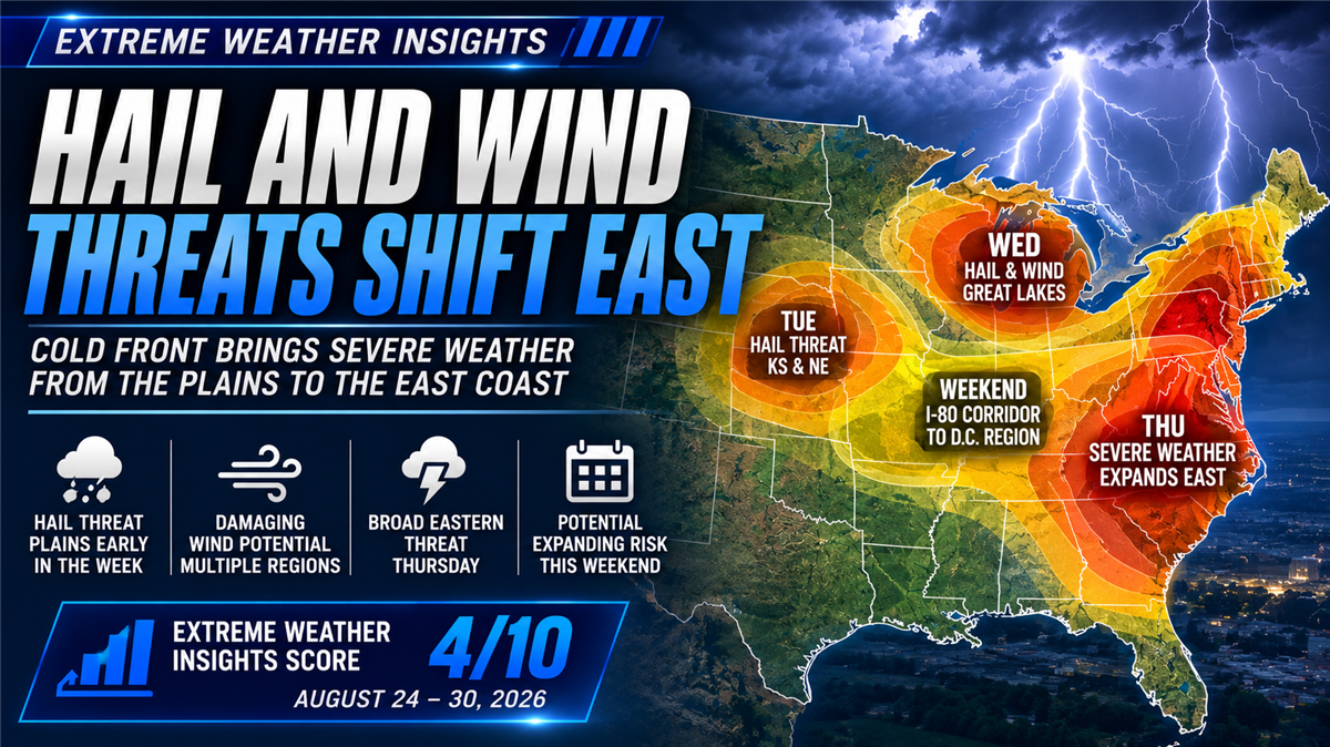
Extreme Weather Insights: Hail and Wind Threats Shift East August 24–30
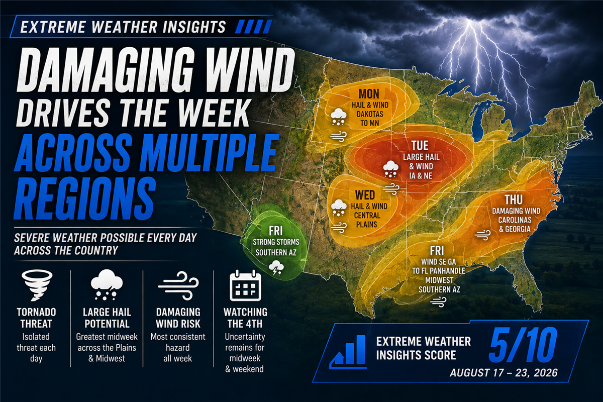
Extreme Weather Insights: Damaging Wind Remains the Story for August 17–23

In an AI-Generated World, Real Work Stands Out
Subscribe to Predictive Sales AI, LLC's Blog

Comments