Severe weather season is nearing its end, and this week’s forecast may be the quietest we’ve seen all year.
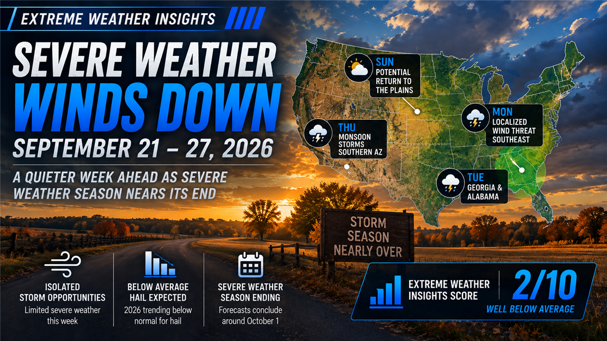
For September 21–27, 2026, Dr. Gensini gives the week an Extreme Weather Insights Score of 2/10, putting severe weather activity well below average. There are a few opportunities for localized damaging winds early in the week, but significant hail and organized severe weather are largely absent from the forecast.
With formal storm season coming to a close, this may also mark the final regular Extreme Weather Insights forecast of 2026.
Last Week: Limited Activity With One Hailstorm Standing Out
Last week carried an Extreme Weather Insights Score of 3/10, and overall activity remained relatively limited.
Wind once again accounted for much of the severe weather that did occur, with scattered reports across the Midwest and portions of the Ohio River Valley.
One event stood out, however.
A significant hailstorm developed across eastern Colorado just south of Interstate 70, tracking toward western Kansas. The storm moved through a relatively low-population area, but produced an impressive hail event that was not strongly anticipated in the original forecast.
It was a reminder that even during quieter late-season patterns, isolated opportunities can still develop.
2026 Is Finishing With Two Very Different Storm Stories
As the season winds down, the final hail and wind numbers continue to move in very different directions.
There have been approximately 4,900 severe hail reports so far this year. Dr. Gensini expects the final total to finish around or potentially below the roughly 5,100–5,200 reports recorded during each of the previous two years.
That keeps 2026 firmly in the below-average category for hail.
Wind has been a completely different story.
Damaging wind activity will finish the year well above average, with 2026 standing out as one of the most active wind years in recent history. The closest comparison is 2011, another exceptionally active severe-weather season.
For roofing and exterior contractors, that difference has been one of the defining characteristics of the 2026 storm season: fewer hail events, but exceptionally high damaging wind activity.
Monday: Localized Damaging Wind Across the Southeast
The week begins with scattered showers and thunderstorms across several parts of the country, including the Midwest, Central Great Plains and Ohio River Valley.
Most of this activity will primarily produce heavy rainfall rather than significant severe weather.
The best opportunity for stronger storms develops farther south, in a corridor extending from Virginia toward Mississippi.
Markets including Atlanta, Birmingham and potentially Nashville could experience thunderstorms Monday afternoon and evening.
Hail is not expected to be a significant threat. Instead, the primary concern will be localized damaging and gusty winds.
Tuesday: Georgia and Alabama Remain the Focus
Tuesday brings a similar setup, although the potential storm corridor becomes more concentrated.
The primary area to monitor includes:
Georgia
Alabama
Portions of southern Tennessee
Once again, hail is not expected.
Any stronger storms that develop will primarily carry the potential for localized damaging winds.
Wednesday: Little Severe Weather Expected
By Wednesday, meaningful severe-weather opportunities become difficult to find.
While showers and thunderstorms may still occur in parts of the country, the atmospheric ingredients needed for significant hail, damaging winds or organized severe thunderstorms are largely absent.
For contractors monitoring storm opportunities, Wednesday currently offers very little to act on.
Thursday: Monsoon Storms Possible in Southern Arizona
Thursday provides one of the few additional areas worth monitoring.
The ongoing monsoon pattern across the Intermountain West could support thunderstorms across southern Arizona, continuing a pattern of heavy rain and thunderstorm activity in the region.
This remains a limited opportunity rather than a significant severe-weather setup.
Friday Through Sunday: A Very Quiet Finish
The forecast becomes even quieter heading into the weekend.
There is currently little indication of significant hail or organized severe thunderstorms on Friday, Saturday or Sunday.
There is some possibility that storm activity could begin returning to the Great Plains by Sunday, but the signal is currently too weak to identify a meaningful severe-weather corridor.
Overall, the majority of the week looks exceptionally quiet.
What Roofing Contractors Should Watch This Week
With an Extreme Weather Insights Score of just 2/10, contractors should expect far fewer storm opportunities than during the spring and summer.
The limited areas worth monitoring include:
Monday: Virginia through Mississippi, including Atlanta, Birmingham and potentially Nashville, for localized damaging winds.
Tuesday: Georgia, Alabama and southern Tennessee for another localized wind opportunity.
Wednesday: No significant severe-weather opportunity expected.
Thursday: Southern Arizona could see monsoon-driven thunderstorms.
Friday–Saturday: Little significant hail or severe thunderstorm activity expected.
Sunday: A low-confidence signal could begin returning to the Great Plains.
This is not a week for broad storm-market activation. Instead, teams should watch for isolated events and use actual storm data to determine whether meaningful opportunities develop.
The 2026 Severe Weather Season Is Coming to an End
This forecast may represent the conclusion of the regular 2026 Extreme Weather Insights season.
PSAI typically concludes its formal severe-weather forecasts around October 1, and current weather patterns suggest there may not be enough significant activity to warrant another regular weekly outlook.
That doesn’t mean severe weather becomes impossible.
If meaningful storm opportunities develop later this fall or even during November or December, we’ll continue to provide updates when there is something contractors should be watching.
But for now, the bulk of the 2026 severe weather season appears to be behind us.
From Forecast to Action
A quieter forecast makes precision even more important.
When widespread hail and wind events are occurring every week, contractors may have several markets competing for attention. Late in the season, the challenge changes: identifying the isolated storms that actually create an opportunity.
PSAI Extreme Weather Intelligence helps roofing and exterior contractors track hail and wind activity, identify impacted neighborhoods and build targeted audiences around the areas where weather actually occurred.
Monitor the storm → Identify impacted areas → Prioritize opportunity → Build an audience → Activate targeted outreach
The significant eastern Colorado hailstorm last week is a good example. It developed during an otherwise quiet week and in an area that was not a major focus of the original forecast. Real-time and historical storm intelligence can help teams identify those events even when they occur outside the week's primary forecast zones.
Bottom Line
The September 21–27 Extreme Weather Insights Score is 2/10, making this a well-below-average week for severe weather.
Localized damaging winds are possible across portions of the Southeast Monday and Tuesday, with Atlanta, Birmingham, Nashville and surrounding markets among the areas to monitor. Beyond that, significant severe weather becomes difficult to find.
More importantly, this week may mark the end of the regular 2026 Extreme Weather Insights season.
Hail is positioned to finish below average, while damaging wind will finish well above average and among the most active years in recent history.
We’ll continue monitoring the weather and alert contractors if meaningful opportunities emerge later this year. Otherwise, Extreme Weather Insights will return for the 2027 severe weather season.
Extreme Weather Insights: Severe Weather Season Winds Down September 21–27

Turn More Website Visitors Into Customers With the New Project Showcase Widget

Exterior Source & Bath Source: Building a Stronger Digital Foundation for Sustainable Growth
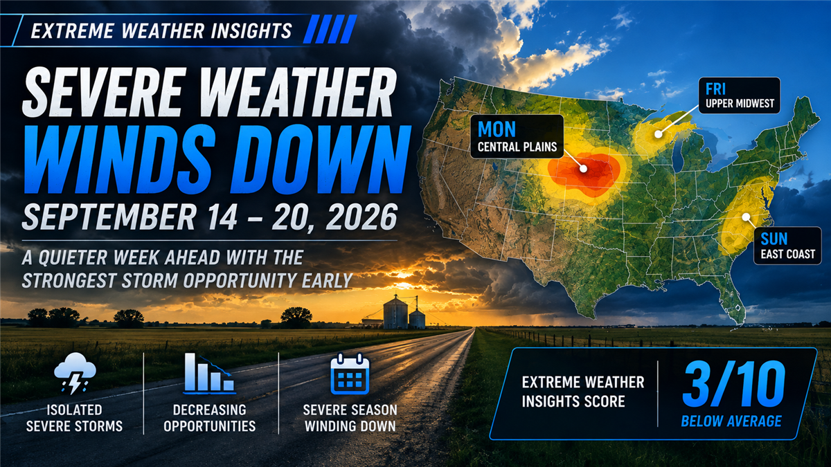
Extreme Weather Insights: Severe Weather Winds Down September 14–20
Subscribe to Predictive Sales AI, LLC's Blog

Comments